By Paul Homewood
h/t Ian Magness
An exposure of just how strong the UHI effect can be:
.

A recent NASA map provides a stark visualization of the extreme temperatures that pavement can reach in Phoenix, Arizona, during periods of intense heat.
Contact burns from hot pavement are an often-overlooked threat during searing heat waves.
A recent NASA map showcases how hot pavement can get in Phoenix, Arizona. Researchers at NASA’s Jet Propulsion Laboratory (JPL) found some sidewalks and roads reaching temperatures capable of causing second-degree burns on contact.
“We create these maps to be intuitive to users and help make data more accessible to the public and citizens scientists,” said Glynn Hulley, a JPL climate researcher.
Notably, Phoenix is the fifth-most populated city in the US. The map encompassed a network of streets and walkways around the city, exposing how urban landscapes devoid of trees can become heat traps.
The map visualization mainly depicts asphalt and concrete surfaces colored by temperature (yellow, red, and purple).
These surfaces act like giant heat sponges, soaking up and radiating strong heat to dangerously high temperatures (at least 120°F/49°C). As per the NASA release, a single touch may cause burns in seconds during heat waves.
The data highlighted areas like Maryvale and Central City, with limited parks and trees, as experiencing some of the highest surface temperatures. In contrast, neighborhoods with trees, such as Encanto and Camelback East, benefited from a cooling effect.
Surprisingly, the hottest land surface temperature within Phoenix was recorded not on a street or sidewalk but at Sky Harbor International Airport, where it reached a scorching 140°F (60°C).

Climate change is pushing temperatures higher across the globe, which could worsen the hot pavement problem that plagues many cities. Due to its dark color and material composition, asphalt absorbs 95% of the sun’s radiation.
On hot days, this might easily raise roadway temperatures by 40 to 60 degrees F (22 to 33 degrees C) above the air temperature. If left unchecked, this issue could become even more severe in the future.
https://interestingengineering.com/science/skin-searing-sidewalks-us-nasa-heatmap
.
There’s the usual nonsense about climate change, but with road surface temperatures inflated by 60F, that heat has to go somewhere, and that is back up in the air.
And the tarmac and concrete runways at the airport gets even hotter apparently..
Phoenix’s main weather station is at the International Airport, and has been there since 1930, two years after the airport opened. It is situated about 50m from the taxiing area, marked in blue, close enough to the runways to provide accurate temperature data for the aircraft.

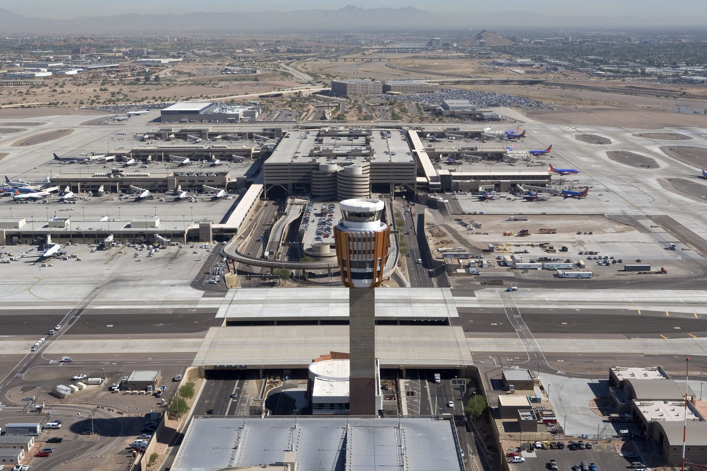
When the airport opened, it was just a field with a few biplanes taking off. Now it covers 3400 acres, most of which is concreted over.
It is hard to think of a worse place to measure temperature trends.
I